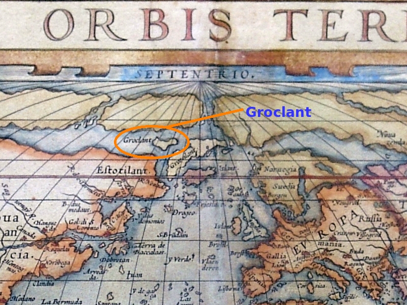
Groclant

Groclant
Groclant dibujada al oeste de Groenlandia, en un famoso mapa de Abraham Ortelius de 1572.

Groclant o Grocland o Groclandia, nombre de una "isla fantasma" que se suponía ubicada al oeste de Groenlandia y que aparece en diversos mapas hasta fines del siglo XVI.

El origen de esta isla fantasma se remonta a una lectura errónea del nombre Groenlandia (Grønland en danés , antiguamente Grœnnland, algunas veces abreviado Groẽnland) y a la confusión con islas como la de Baffin u otras de la actual región canadiense de Nunavut.

Uno de los primeros mapas en los que aparece es el de Mercator de 1569 y uno de los últimos es el de Quadus de 1608.


Wikimedia foundation. 2010.

Игры ⚽ Поможем написать курсовую

Mira otros diccionarios:

  • Groclant — is the name of a phantom island generally shown off the western side of Greenland, first appearing on maps in the late 16th century. It may be due to erroneous reading of the name of Greenland from a map (it was sometimes labeled Groẽland), or it …   Wikipedia

  • Groclant — est le nom d une île fantôme qui était censée être située à l ouest du Groenland et qui est apparue sur les cartes vers la fin des années 1500. Il s agit peut être d une lecture erronée du nom du Groenland sur une carte, ou de l île de Baffin ou… …   Wikipédia en Français

  • Phantom island — The Zeno map of 1558 showing Frisland – a phantom island in the North Atlantic Phantom islands are islands that were believed to exist, and appeared on maps for a period of time (sometimes centuries) during recorded history, but were later… …   Wikipedia

  • Phantominsel — Karte von Nicolo Zeno, 1558 Phantominseln oder Scheininseln (oder auch Flyaway Islands als englischer Begriff für Phantominseln im Atlantik) sind Inseln, die auf historischen Karten verzeichnet oder in historischen Schriftstücken beschrieben sind …   Deutsch Wikipedia

  • Ile fantome — Île fantôme Une île fantôme est une île dont l existence était admise et qui était mentionnée sur des cartes pendant un certain temps (parfois des siècles) mais qui en fut ensuite retirée parce qu il fut prouvé qu elle n existait pas. Sommaire 1… …   Wikipédia en Français

  • Index alphabétique maritime — Projet:Maritime/Index Projet maritime Bistro du port Participants Actualités   Agenda Outils À faire …   Wikipédia en Français

  • Île fantôme — Une île fantôme est une île dont l existence était admise et qui était mentionnée sur des cartes pendant un certain temps (parfois des siècles) mais qui en fut ensuite retirée parce qu il fut prouvé qu elle n existait pas. Sommaire 1 Origine 2… …   Wikipédia en Français

  • Thule — Este artículo trata sobre el término que aparece en las fuentes antiguas. Para el antiguo nombre de una localidad groenlandesa, véase Qaanaaq. Thule como Tile en la Carta Marina de Magnus. Thule o Tile (Θούλη, Tuli o Tyle) es un término usado e …   Wikipedia Español

  • Гроклант — (Groclant)  остров призрак, впервые изображённый на картах к западу от Гренландии в конце XVI века. Возможны следующие причины этой ошибки: На карте было неправильно прочитано название Гренландии (иногда Гренландию писали как Groẽnland) За… …   Википедия

Compartir el artículo y extractos

Link directo
Do a right-click on the link above
and select “Copy Link”