Generic Mapping Tools

Generic Mapping Tools
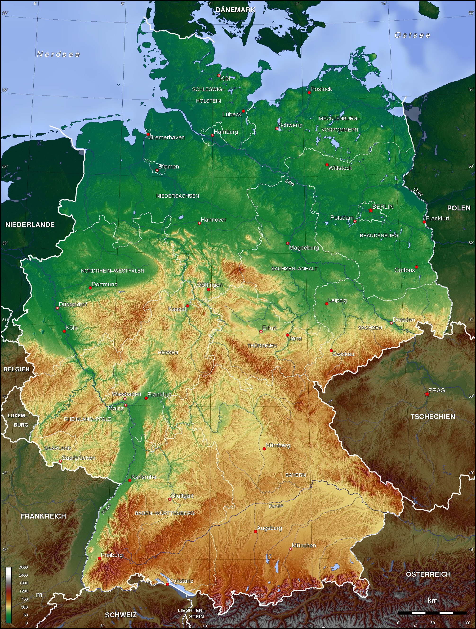
Mapa topográfico de Alemania.

GMT (acrónimo del inglés Generic Mapping Tools) es una colección de programas de código abierto para la confección de diagramas y mapas geológicos o geográficos.

GMT ofrece herramientas para elaborar registros de datos en 2 y 3 dimensiones, por ejemplo filtrar, segregar o representar diferentes proyecciones geográficas. Se entrega además una nutrida colección de registros SIG de libre utilización, que contiene costas, ríos, fronteras nacionales y coordenadas de otros objetos geográficos. Otros datos (fotografías desde satélites, modelos digitales de terreno, etc.) pueden ser convertidos e importados al sistema. Los mapas confeccionados se generan en Postscript. El sistema está optimizado para su utilización en el intérprete de comandos del sistema operativo con el fin de permitir el uso de guiones en el procesamiento por lotes. Existen intefaces gráficas de usuario ofrecidas por terceros, a veces disponibles en Internet, que permiten ofrecer el servicio en la red.

Véase también

  • Taller de confección de mapas con GMT

Otros enlaces


Wikimedia foundation. 2010.

Игры ⚽ Поможем сделать НИР

Mira otros diccionarios:

  • Generic Mapping Tools — Entwickler Paul Wessel und Walter H. F. Smith Aktuelle Version 4.5.7 (15. Juli 2011) Betriebssystem Linux, Mac OS X, Windows Kategorie Kartensoft …   Deutsch Wikipedia

  • Generic Mapping Tools — (GMT) Тип генератор карт Написана на C/C++ …   Википедия

  • Generic Mapping Tools — (GMT) is an open source collection of tools for processing and displaying xy and xyz datasets, including rasterisation, filtering and other image processing operations, and various kinds of map projections. A comprehensive collection of free GIS… …   Wikipedia

  • Generic Mapping Tools — Pour les articles homonymes, voir GMT. Logo GMT …   Wikipédia en Français

  • Data mapping — Data transformation/Source transformation Concepts metadata · data mapping data transformation · model transf …   Wikipedia

  • Software tools for molecular microscopy — There are a large number of software tools or software applications that have been specifically developed for the field sometimes referred to as molecular microscopy or cryo electron microscopy or cryoEM. Several special issues of the Journal of… …   Wikipedia

  • Gebco — (General Bathymetric Chart of the Oceans) ist ein bathymetrischer, weltweiter Datensatz. Er basiert auf zusammengetragenen Daten aus Schiffs Echoloten. Somit ist er sehr genau für häufig befahrene Seewege. Die Topografie wurde anhand von… …   Deutsch Wikipedia

  • Sistema de Información Geográfica — En la imagen capas raster y vectoriales en el SIG de código libre QGIS, usado como interfaz gráfica de usuario de GRASS …   Wikipedia Español

  • Работа с GMT под Windows — Связать? …   Википедия

  • Map projection — A medieval depiction of the Ecumene (1482, Johannes Schnitzer, engraver), constructed after the coordinates in Ptolemy s Geography and using his second map projection A map projection is any method of representing the surface of a sphere or other …   Wikipedia

Compartir el artículo y extractos

Link directo
Do a right-click on the link above
and select “Copy Link”