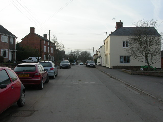
Yelvertoft

Yelvertoft
Yelvertoft
Pueblo y parroquia civil del Reino Unido
Yelvertoft, High Street - geograph.org.uk - 1740028.jpg
Yelvertoft
Yelvertoft
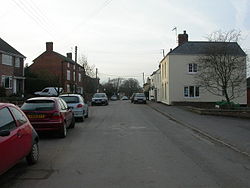
Ubicación en Northamptonshire.
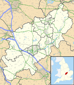
52°22′31.8432″N 1°7′38.8416″O / 52.375512, -1.127456Coordenadas: 52°22′31.8432″N 1°7′38.8416″O / 52.375512, -1.127456
Entidad Pueblo y parroquia civil
 • País Bandera del Reino Unido Reino Unido
 • Nación constitutiva Inglaterra
 • Región Midlands del Este
 • Condado Northamptonshire
 • Distrito Daventry
Población (2001)  
 • Total 821 hab.
Código postal NN6
Prefijo telefónico 01788

Yelvertoft es un pueblo y una parroquia civil del distrito de Daventry, en el condado de Northamptonshire (Inglaterra).

Demografía

Según el censo de 2001,[1] Yelvertoft tenía 821 habitantes (408 varones y 413 mujeres). 161 (19,61%) de ellos eran menores de 16 años, 597 (72,72%) tenían entre 16 y 74, y 63 (7,67%) eran mayores de 74. La media de edad era de 41,33 años. De los 660 habitantes de 16 o más años, 129 (19,54%) estaban solteros, 428 (64,85%) casados, y 103 (15,61%) divorciados o viudos. 414 habitantes eran económicamente activos, 401 de ellos (96,86%) empleados y otros 13 (3,14%) desempleados. Había 6 hogares sin ocupar y 335 con residentes.

Evolución demográfica de Yelvertoft
1801 1811 1821 1831 1841 1851 1861 1871 1881 1891 1901 1911 1921 1931 1941 1951 1961
526 598 654 596 618 714 - - 499 392 387 360 367 349 - 462 451
(Fuente:Vision of Britain )

Referencias

  1. «Yelvertoft» (en inglés). Office for National Statistics. Consultado el 1 de julio de 2011.

Enlaces externos


Wikimedia foundation. 2010.

Игры ⚽ Поможем решить контрольную работу

Mira otros diccionarios:

  • Yelvertoft — is a village in the Daventry district of the county of Northamptonshire in England. Yelvertoft s main thoroughfare, called High Street, is approximately three quarters of a mile long, from the Parish Church of All Saints to the Village Hall.… …   Wikipedia

  • River Nene — River The River Nene at Kislingbury Watermill, Northamptonshir …   Wikipedia

  • Crick, Northamptonshire — Coordinates: 52°20′54″N 1°08′15″W / 52.3484°N 1.1374°W / 52.3484; 1.1374 …   Wikipedia

  • Badby — Coordinates: 52°14′N 1°11′W / 52.23°N 1.18°W / 52.23; 1.18 …   Wikipedia

  • Newnham, Northamptonshire — For other uses, see Newnham (disambiguation). Coordinates: 52°14′N 1°08′W / 52.23°N 1.13°W / 52.23; 1.13 …   Wikipedia

  • Dodford, Northamptonshire — Coordinates: 52°14′N 1°06′W / 52.23°N 1.10°W / 52.23; 1.10 …   Wikipedia

  • Peterborough — This article is about the city in the United Kingdom. For other uses, see Peterborough (disambiguation). Peterborough   City and unitary authority   …   Wikipedia

  • Northampton — This article is about Northampton in England. For other places of the same name, see Northampton (disambiguation). Borough of Northampton   Town Borough   …   Wikipedia

  • Naseby — For the place in Otago, New Zealand, see Naseby, New Zealand. For the battle of Naseby, see Battle of Naseby. Coordinates: 52°23′49″N 0°59′18″W / 52.39692°N 0.988 …   Wikipedia

  • Daventry — For other uses, see Daventry (disambiguation). Coordinates: 52°16′N 1°10′W / 52.26°N 1.16°W / 52.26; 1.16 …   Wikipedia

Compartir el artículo y extractos

Link directo
Do a right-click on the link above
and select “Copy Link”