Turtle Bay (Manhattan)

Turtle Bay (Manhattan)

Coordenadas: 40°45′19″N 73°58′3″W / 40.75536, -73.967412

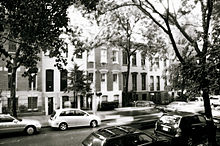
Casas tradicionales en Turtle Bay.

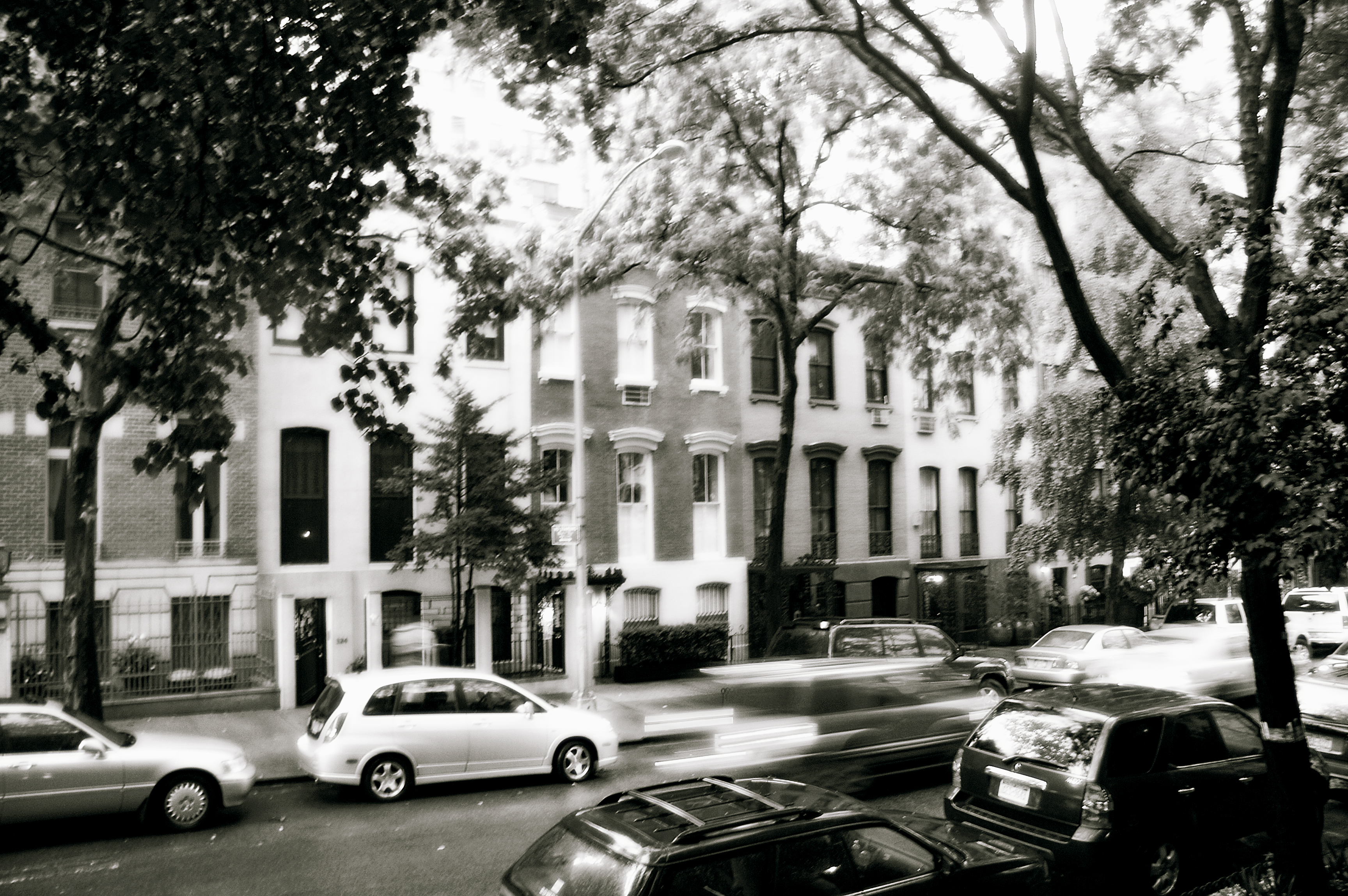
Turtle Bay es un barrio ubicado en la Ciudad de Nueva York, en Midtown Manhattan. Se extiende entre las calles 41 y 53, y al este de la Avenida Lexington al Río Este, a través de Roosevelt Island.[1] Es el sitio de la Sede de las Naciones Unidas y el Edificio Chrysler.

Turtle Bay se encuentra a orillas del Río Este, convirtiéndose en un sitio de construcción de barcos. Sin embargo para 1868, la bahía fue empezando a ser llenada por desarrollos comerciales, llenos de mataderos y muelles.

El barrio Turtle Bay fue originalmente de 40-acres (160,000 m²) dada a ingleses por el gobernador colonial neerlandés de Nueva Ámsterdam en 1639, y lo llamó "Turtle Bay Farm". Después que se inició el plan hipodámico en Manhattan, el paisaje de colinas de Turtle Bay Farm fue emparejado para crear calles y los terrenos fueron subsidiados para desarrollos residenciales.

Véase también

  • Barrios de Manhattan

Referencias

  1. "Map." Turtle Bay Association. Consultado enero 25, 2009.

Enlaces externos


Wikimedia foundation. 2010.

Игры ⚽ Поможем написать реферат

Mira otros diccionarios:

  • Turtle Bay, Manhattan — Turtle Bay is a neighborhood in New York City, on the east side of Midtown Manhattan. It extends between 42nd and 53rd Streets, and eastward from Lexington Avenue to the East River, across from Roosevelt Island. It was named after an actual bay… …   Wikipedia

  • Turtle Bay — may refer to: *Turtle Bay, O ahu, Hawaii; *Turtle Bay, Manhattan, New York City; *Turtle Bay, Texas; *Turtle Bay, Republic of Mauritius; *Turtle Bay (North Queensland), Queensland, Australia, near Cairns; *Turtle Bay (Cumberland Islands),… …   Wikipedia

  • Turtle Bay — 40° 45′ 19″ N 73° 58′ 03″ W / 40.75536, 73.96741 Turtle Bay est un quartier d …   Wikipédia en Français

  • Turtle Bay — geographical name section of New York City in E central Manhattan on East River; site of United Nations headquarters …   New Collegiate Dictionary

  • Manhattan Community Board 5 — is a local government unit of New York City, New York in the United States. It encompasses Midtown, Times Square, most of the Theatre District, the Diamond District, the Garment District, Herald Square, Korea …   Wikipedia

  • Manhattan — 40°43′42″N 73°59′39″O / 40.72833, 73.99417 …   Wikipédia en Français

  • Manhattan Community Board 6 — Community Board 6 Manhattan Community Board 6 is a local government unit of New York City, New York, United States. Its area of responsibility encompasses the East Side of Manhattan from 14th Street to 59th Street. This includes the …   Wikipedia

  • Manhattan — New York Island redirects here. For the Pacific island, see Teraina. For other uses, see Manhattan (disambiguation). Manhattan   Borough of New York City   New York County …   Wikipedia

  • Manhattan Community Board 1 — Community Board 1 The Manhattan Community Board 1 is a local government unit of the city of New York, encompassing the neighborhoods of Battery Park City, the Financial District, the South Street Seaport, and TriBeCa in Lower Manhattan …   Wikipedia

  • Manhattan Valley — The castle like onetime New York Cancer Hospital,[1] built in 1887, now converted to a condominium, at 455 Central Park West in Manhattan Valley. Manhattan Valley is a neighborhood on the Upper West Side of Manhattan in New York City, bound …   Wikipedia

Compartir el artículo y extractos

Link directo
Do a right-click on the link above
and select “Copy Link”