Townshend (Vermont)

Townshend (Vermont)
Townshend
Pueblo de los Estados Unidos
Townshend
Townshend
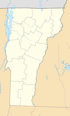
Ubicación en el condado de Windham en Vermont
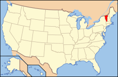
Ubicación de Vermont en EE. UU.
43°2′50″N 72°41′2″O / 43.04722, -72.68389Coordenadas: 43°2′50″N 72°41′2″O / 43.04722, -72.68389
Entidad Pueblo
 • País Bandera de los Estados Unidos Estados Unidos
 • Estado Flag of Vermont.svg Vermont
 • Condado Windham
Superficie  
 • Total 110,8 km²
 • Tierra 110,6 km²
 • Agua (0,14%) 0,2 km²
Altitud  
 • Media 247 msnm
Población (2010)  
 • Total 1.232 hab.
 • Densidad 11,12 hab/km²
Huso horario Este: UTC-5
 • en verano UTC-4
Código ZIP 05353, 05359
Código de área 802

Townshend es un pueblo ubicado en el condado de Windham en el estado estadounidense de Vermont. En el año 2010 tenía una población de 1,232 habitantes y una densidad poblacional de 11 personas por km².[1]

Contenido

Geografía

Townshend se encuentra ubicado en las coordenadas 43°2′50″N 72°41′2″O / 43.04722, -72.68389Coordenadas: 43°2′50″N 72°41′2″O / 43.04722, -72.68389.[2]

Demografía

Según la Oficina del Censo en 2000 los ingresos medios por hogar en la localidad eran de $39,286 y los ingresos medios por familia eran $41,759. Los hombres tenían unos ingresos medios de $31,667 frente a los $22,313 para las mujeres. La renta per cápita para la localidad era de $19,431. Alrededor del 8.8% de la población estaban por debajo del umbral de pobreza.[3]

Referencias

  1. «Encuentra un condado» (en inglés). Asociación Nacional de Condados (11 de julio de 2011). Consultado el 11 de julio de 2011.
  2. «U.S. Gazetteer: Censo de 2010» (en inglés). Oficina del Censo de los Estados Unidos (16 de febrero de 2011). Consultado el 11 de julio de 2011.
  3. «American FactFinder» (en inglés). Oficina del Censo de los Estados Unidos. Consultado el 11 de julio de 2011.

Enlaces externos


Wikimedia foundation. 2010.

Игры ⚽ Нужно сделать НИР?

Mira otros diccionarios:

  • Townshend, Vermont — Infobox Settlement official name = Townshend, Vermont settlement type = Town nickname = motto = imagesize = image caption = image mapsize = 250px map caption = Townshend, Vermont mapsize1 = map caption1 = subdivision type = Country subdivision… …   Wikipedia

  • Townshend — ist der Familienname folgender Personen: Charles Vere Ferrers Townshend (1861–1924), britischer Offizier Charles Townshend, 2. Viscount Townshend (1674–1738), britischer Politiker und Minister George Townshend (1876–1957), aus Dublin stammender… …   Deutsch Wikipedia

  • Vermont locations by per capita income — Vermont has the twenty fifth highest per capita income in the United States of America, at $20,625 (2000). Its personal per capita income is $30,740 (2003).Vermont counties ranked by per capita incomeThere are fourteen counties located in Vermont …   Wikipedia

  • Vermont Route 30 — Route information Maintained by VTrans Length: 111.914 mi …   Wikipedia

  • Vermont Agency of Agriculture Food and Markets — The Vermont Agency of Agriculture Food and Markets (VAAFM) or sometimes colloquially the agriculture department, is a Vermont executive agency (or cabinet agency). Its purpose is to develop and execute policy on farming, agriculture, food, and… …   Wikipedia

  • Charles Townshend — For other people named Charles Townshend, see Charles Townshend (disambiguation). The Right Honourable Charles Townshend PC …   Wikipedia

  • List of Vermont state forests — Vermont state forests= NameLocation (by alphabetical order) (of main entrance) Aitken State ForestRutland CountyAlbert C Lord State ForestWindsor CountyArlington State ForestBennington CountyCalvin Coolidge State ForestRutland CountyCalvin… …   Wikipedia

  • National Register of Historic Places listings in Windham County, Vermont — Location of Windham County in Vermont This is a list of the National Register of Historic Places listings in Windham County, Vermont. This is intended to be a complete list of the properties and districts on the National Register of Historic… …   Wikipedia

  • Historical U.S. Census totals for Windham County, Vermont — This article shows U.S. Census totals for Windham County, Vermont, broken down by municipality, from 1900 to 2000.Most areas of New England are entirely divided into incorporated municipalities, with no unincorporated territory. In the three… …   Wikipedia

  • West River (Vermont) — The West River is a tributary of the Connecticut River, about 50 mi (80 km) long, in southern Vermont in the United States. [http://www.bartleby.com/69/18/W02318.html Columbia Gazetteer of North America entry] ] According to the Geographic Names… …   Wikipedia

Compartir el artículo y extractos

Link directo
Do a right-click on the link above
and select “Copy Link”