Muttontown

Muttontown
Muttontown
Villa de los Estados Unidos
Muttontown
Muttontown
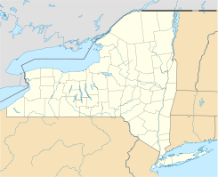
Ubicación en el condado de Nassau y en el estado de Nueva York
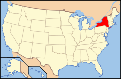
Map of USA NY.svg
Ubicación de Nueva York en EE. UU.
40°49′20″N 73°31′37″O / 40.82222, -73.52694Coordenadas: 40°49′20″N 73°31′37″O / 40.82222, -73.52694
Entidad Villa
 • País Bandera de los Estados Unidos Estados Unidos
 • Estado Flag of New York.svg Nueva York
 • Condado Nassau
 • Pueblo Oyster Bay
Alcalde Julianne Wesley
Superficie  
 • Total 15,8 km²
 • Tierra 15,8 km²
 • Agua (0%) 0 km²
Altitud  
 • Media 87 msnm
Población (2000)  
 • Total 3.412 hab.
 • Densidad 216.4 hab/km²
Huso horario Este: UTC-5
 • en verano UTC-4
Código postal 11765
Prefijo telefónico 516

Muttontown es una villa ubicada en el condado de Nassau en el estado estadounidense de Nueva York. En el año 2000 tenía una población de 3.412 habitantes y una densidad poblacional de 216,4 personas por km². Muttontown se encuentra dentro del pueblo de Oyster Bay.

Contenido

Geografía

Muttontown se encuentra ubicada en las coordenadas 40°49′20″N 73°31′37″O / 40.82222, -73.52694. Según la Oficina del Censo, la ciudad tiene un área total de 15,8 km² (6,1 mi²), de la cual 15,8 km² (6,1 mi²) es tierra y 0,9 km² (0,3 mi²) (11.95%) es agua.

Demografía

Según la Oficina del Censo en 2000 los ingresos medios por hogar en la localidad eran de $184,386, y los ingresos medios por familia eran $190,358. Los hombres tenían unos ingresos medios de $100,000 frente a los $53,846 para las mujeres. La renta per cápita para la localidad era de $88,020. Alrededor del 3.4% de la población estaban por debajo del umbral de pobreza.[1]

Referencias

  1. «U.S. Gazetteer: Censo de 2010» (en inglés). Oficina del Censo de los Estados Unidos (16 de febrero de 2011). Consultado el 11 de julio de 2011.

Enlaces externos


Wikimedia foundation. 2010.

Игры ⚽ Нужен реферат?

Mira otros diccionarios:

  • Muttontown — Muttontown, NY U.S. village in New York Population (2000): 3412 Housing Units (2000): 1048 Land area (2000): 6.087801 sq. miles (15.767331 sq. km) Water area (2000): 0.000000 sq. miles (0.000000 sq. km) Total area (2000): 6.087801 sq. miles… …   StarDict's U.S. Gazetteer Places

  • Muttontown, NY — U.S. village in New York Population (2000): 3412 Housing Units (2000): 1048 Land area (2000): 6.087801 sq. miles (15.767331 sq. km) Water area (2000): 0.000000 sq. miles (0.000000 sq. km) Total area (2000): 6.087801 sq. miles (15.767331 sq. km)… …   StarDict's U.S. Gazetteer Places

  • Muttontown — Original name in latin Muttontown Name in other language State code US Continent/City America/New York longitude 40.82399 latitude 73.54763 altitude 97 Population 3497 Date 2011 05 14 …   Cities with a population over 1000 database

  • Muttontown, New York —   Village   U.S. Census Map …   Wikipedia

  • Nassau County, New York — There is also a Town of Nassau in Rensselaer County. Nassau County, New York …   Wikipedia

  • Oyster Bay (town), New York — This article is about the town. For the unincorporated hamlet within the town, see Oyster Bay (hamlet), New York. Oyster Bay   Town   Town of Oyster Bay …   Wikipedia

  • National Register of Historic Places listings in Oyster Bay (town), New York — Map of all coordinates from Google Map of all coordinates from Bing …   Wikipedia

  • U.S. Immigration and Customs Enforcement — Abbreviation ICE ICE is a component of the United States Department of Homeland Security …   Wikipedia

  • Oyster Bay (hamlet), New York — This article is about the unincorporated hamlet. For the town encompassing the hamlet, see Town of Oyster Bay, New York. Oyster Bay, New York   Village   Downtown Oyster …   Wikipedia

  • New York State Route 25A — NYS Route 25A Route information Auxiliary route of NY 25 Maintained by NYSDOT and NYCDOT …   Wikipedia

Compartir el artículo y extractos

Link directo
Do a right-click on the link above
and select “Copy Link”