Marshallkreek

Marshallkreek
Marchallkreek
Brokopondo resorts.png
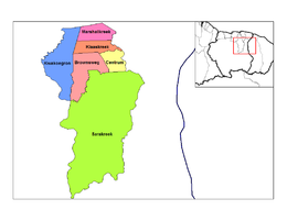
Distrito de Brokopondo, Marchallkreek en verde claro
País Surinam Bandera de Surinam
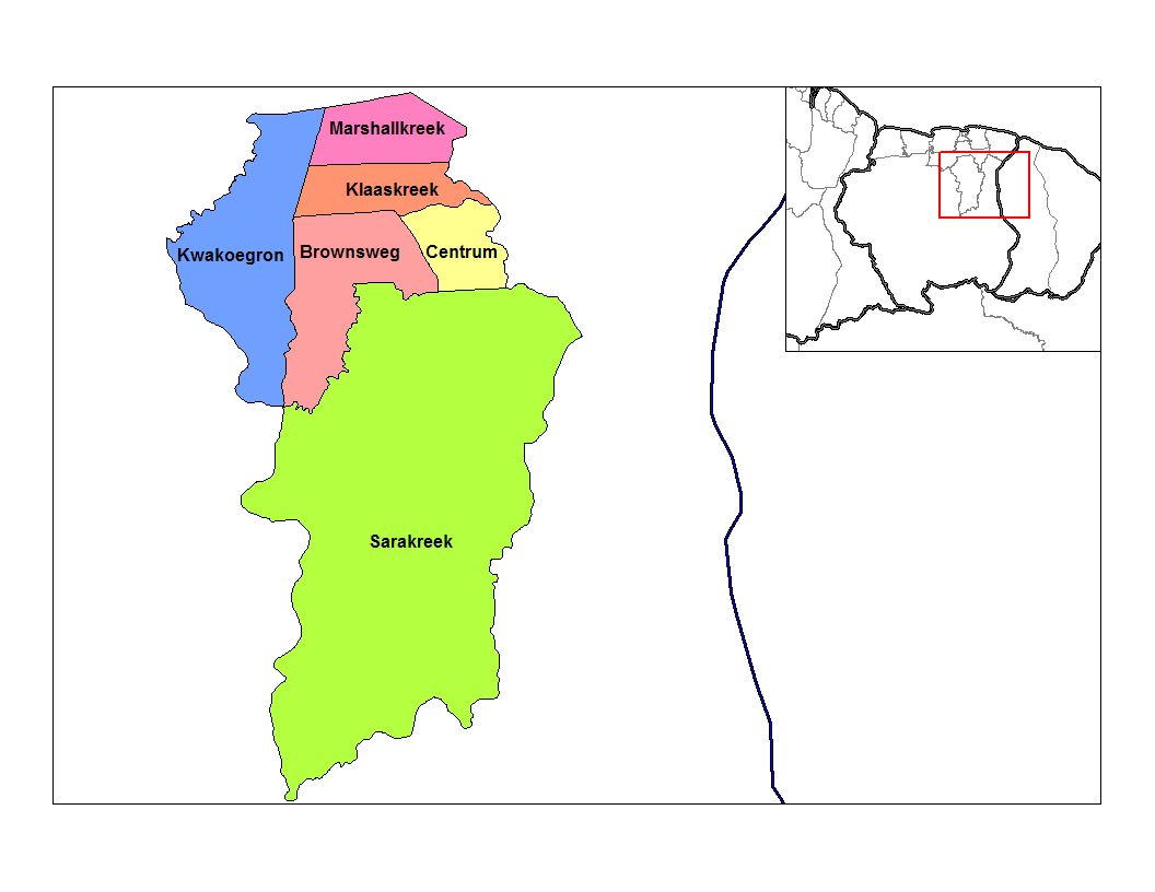
• Distrito Brokopondo
• Suburbio Marchallkreek
Ubicación 4°54′N 55°5′O / 4.9, -55.083
Población 1,001[1] hab. (2004)
Huso horario UTC-3

Marchallkreek es uno de los seis suburbios, o en neerlandés ressort, en los que se divide el distrito de Brokopondo en Surinam, es el suburbio más grande del distrito y se ubica en su extremo sur, contiene completamente el Embalse Brokopondo que le da importancia al distrito.

Limita al norte con la ciudad de Brokopondo, al este, al sur y al oeste con el distrito de Sipaliwini, al noroeste con el suburbio de Brownsweg.

En 2004, Marchallkreek, según cifras de la Oficina Central de Asuntos Civiles tenía 1,001 habitantes.


Referencias

  1. statoids.com. «Datos estadísticos de Marchallkreek en Statoids.com» (en inglés). Consultado el 11 de junio de 2010.

Wikimedia foundation. 2010.

Игры ⚽ Поможем решить контрольную работу

Mira otros diccionarios:

  • Marshallkreek —   Resort   …   Wikipedia

  • Districts of Suriname — Suriname This article is part of the series: Politics and government of Suriname Constitution President …   Wikipedia

  • Commewijne District — Map of Suriname showing Commewijne district Commewijne is a district of Suriname, located on the right bank of the Suriname River. Commewijne s capital city is Nieuw Amsterdam. Alliance is another major town. The district has a population of… …   Wikipedia

  • Brokopondo District — Brokopondo is a district of Suriname. Its capital city is Brokopondo; other towns include Brownsweg and Kwakoegron.The district has a population of 8,340, and an area of 7,364 square kilometres.Brokopondo district is the site of a large reservoir …   Wikipedia

  • Coronie District — Map of Suriname showing Coronie district Coronie is a district of Suriname, situated on the coast. Coronie s capital city is Totness, with other towns including Corneliskondre, Friendship, Jenny. The district border the Atlantic Ocean to the… …   Wikipedia

  • Marowijne District — Map of Suriname showing Marowijne district Marowijne is a district of Suriname, located on the north east coast. Marowijne s capital city is Albina, with other towns including Moengo and Wanhatti. The district borders the Atlantic Ocean to the… …   Wikipedia

  • Nickerie District — Map of Suriname showing Nickerie district Nickerie is a district of Suriname, on the north west coast. Nickerie s capital city is Nieuw Nickerie, the second largest city in the country. Other towns include Washoda and Wageningen. The district… …   Wikipedia

  • Saramacca District — Coordinates: 5°46′57″N 55°37′29″W / 5.7825°N 55.62472°W / 5.7825; 55.62472 …   Wikipedia

  • Moengo —   Resort   Map showing the resorts of Marowijne District …   Wikipedia

  • Nieuw Amsterdam, Suriname — Nieuw Amsterdam   Resort and town   …   Wikipedia

Compartir el artículo y extractos

Link directo
Do a right-click on the link above
and select “Copy Link”