Kawaihae — ▪ Hawaii, United States deepwater port lying along Kawaihae Bay, on the northwestern coast of Hawaii island, Hawaii, U.S. It marks the northernmost point of a 40 mile (65 km) stretch known as the “Gold Coast,” a resort beach development… … Universalium
Kawaihae, Hawai'i — For the hawaiian band, see Kawaihae (band) Kawaihae is a harbour and town on the west side of the Island of Hawaiokinai, 35 miles north of Kailua Kona. The harbour includes a fuel depot, shipping terminal and military landing site. Outside of the … Wikipedia
Kawaihae (band) — Infobox musical artist | Name = Kawaihae Img capt = Img size = Landscape = Background = group or band Origin = flagicon|Japan Tokyo. Japan Genre = Hawaiian Island Years active = 2000 – present Label = Island Cafe (2002), Columbia Japan (2003),… … Wikipedia
Akoni Pule Highway — The okinaAkoni Pule Highway is the name for most of Hawaiokinai State Highway [270] , the main route along the North Kohala Coast on the Island of Hawaiokinai from Kawaihae to okinaUpolu Point and then on to Pololū Valley Lookout. *TOTAL MILES =… … Wikipedia
National Register of Historic Places listings on the island of Hawaii — Location of the island of Hawaii Map … Wikipedia
John Young (Hawaii) — For the 20th century artist, see John Chin Young. John Young Advisor to Kamehameha I Governor of Hawaiʻi Island High Chief Spouse Namokuelua … Wikipedia
Hawaii Belt Road — The Hawaiʻi Belt Road is a modern name for the Māmalahoa Highway and consists of Hawaiʻi state Routes 11, 19, and 190 that encircle the Island of Hawaiʻi. The southern section, between Hilo and Kailua Kona is numbered as Route 11. The section… … Wikipedia
Fanny Kekelaokalani — Fanny Kekuiapoiwa Kekelaokalani Young Lewis Naea (1806 1880), was a Hawaiian high chiefess and mother of one of Hawaii s most well known figure Queen Emma. Fanny was a serious, stable lady and a strict Christian.Early lifeShe was born, July 21,… … Wikipedia
Hawaiʻi State Route 19 — State Route 19 (im Hintergrund) durchquert ein Lavafeld nördlich Kailua Kona Die Hawaiʻi State Route 19 ist eine Straßenverbindung im Norden der Insel Hawaiʻi im Bundesstaat gleichen Namens; sie stellt den nördlichen Teil der Hawaiʻi Belt Road… … Deutsch Wikipedia
Kohala, Hawaii — The districts of the Big Island. From Northernmost, clockwise; Kohala (highlighted), Hāmākua, Hilo, Puna, Kaʻū, Kona … Wikipedia
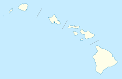
 Kawaihae
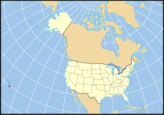
 Estados Unidos
 Hawái
Hawái Portal:Hawái. Contenido relacionado con Hawái.
 Wikimedia Commons alberga contenido multimedia sobre Kawaihae. Commons
