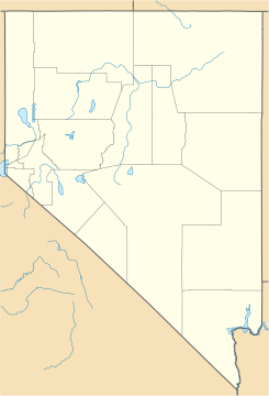
Golconda, Nevada — Golconda is a town in the state of Nevada, USA, named after the ancient diamond mining center of Golkonda in India. It s located in Humboldt County along Interstate 80 in the northwestern part of the state, just east of the city of Winnemucca;… … Wikipedia
Golconda — may be:Places: * Golkonda, ruined city and fortress in India * Golconda, Illinois, town in the United States * Golconda, Nevada, former town in the United StatesOther: * Golconda (painting) * Golconda, state of enlightenment in roleplaying game… … Wikipedia
Golconda — ist der Name mehrerer Orte in den Vereinigten Staaten: Golconda (Colorado) Golconda (Idaho) Golconda (Illinois) Golconda (Nevada) Für die Schreibweise Golkonda siehe Golkonda (Begriffsklärung) Diese Seite ist eine … Deutsch Wikipedia
Nevada in the American Civil War — Union States in the American Civil War … Wikipedia
Nevada Historical Markers — identify significant places of interest in Nevada s history. The Historic Marker Program was initiated by the Nevada State Legislature in 1967 to bring the state s heritage to the public s attention with on site markers. Because of budget cuts… … Wikipedia
Nevada State Route 789 — State Route 789 Getchell Mine Road Route information Maintained by NDOT Length … Wikipedia
Nevada State Route 18 — State Route 18 is the previous designation for State Route 789 and unimproved roads; it was to connect Interstate 80/US 40/State Route 1 at Golconda with State Route 11 near Tuscarora via Midas. The original alignment of State Route 18 is still… … Wikipedia
Nevada State Route 18A — State Route 18A is the previous designation for State Route 806 from Battle Mountain to North Battle Mountain, then via an unimproved road from North Battle Mountain to meet State Route 789 (former State Route 18) northeast of Golconda … Wikipedia
National Register of Historic Places listings in Nevada — Nevada s counties This is a list of properties and historic districts in Nevada that are listed on the National Register of Historic Places. There is at least one listing in each of … Wikipedia
Interstate 80 in Nevada — This article is about the section of Interstate 80 in Nevada. For the entire length of the highway, see Interstate 80. Interstate 80 … Wikipedia
 Golconda
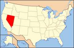
 Estados Unidos
 Nevada
 Portal:Nevada. Contenido relacionado con Nevada.
 Wikimedia Commons alberga contenido multimedia sobre Golconda (Nevada). Commons
