Skerryvore

Skerryvore
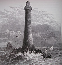
Grabado del siglo XIX del faro en Skerryvore.

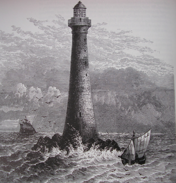
Skerryvore (del gaélico escocés Sgeir Mhor, que significa "roca grande") es una remota isla localizada en el grupo de las Hébridas Interiores, en Escocia.

Como Skerryvore también se conoce el faro localizado en la misma isla, construido con algunas dificultades entre 1838 y 1844 por Alan Stevenson.[1] Con una altura de 48 m, se trata del faro más alto de Escocia.[2]

Referencias

  1. Northern Lighthouse Board (2009). «Historia de Skerryvore» (en inglés). Consultado el 15 de diciembre de 2010.
  2. Northern Lighthouse Board (2009). «Which is the tallest Scottish Lighthouse?» (en inglés). Consultado el 15 de diciembre de 2010.

Coordenadas: 56°19′22.86″N 07°06′51.9″O / 56.3230167, -7.114417


Wikimedia foundation. 2010.

Игры ⚽ Нужно сделать НИР?

Mira otros diccionarios:

  • Skerryvore — Sgeir Mhor (gd) Phare de Skerryvore Géographie Pays …   Wikipédia en Français

  • Skerryvore — (spr. ßkerriwōr), einsamer Felsen, 25 km südwestlich von Tyree, einer der Hebriden, mit kühnem Leuchtturm …   Meyers Großes Konversations-Lexikon

  • Skerryvore — Infobox Scottish island latitude=56.19 longitude= 7.07 GridReference=NL841265 celtic name= An Sgeir Mhòr norse name= meaning of name= The Great Skerry area= 26 m2 area rank= highest elevation= 3 m Population=0 population rank= main settlement=… …   Wikipedia

  • Skerryvore (disambiguation) — Skerryvore may have the following meanings:* Skerryvore lighthouse in Argyll, Scotland.* Skerryvore, Ontario, a small community in Canada located on the shores of Georgian Bay. * A traditional Scottish ceilidh band based in Glasgow.* Home of… …   Wikipedia

  • Skerryvore, Ontario — Skerryvore is a small community in Ontario, Canada located on the shores of Georgian Bay just south of the community of Pointe au Baril Station. It is part of the township of The Archipelago. There are approximately 125 cottages or homes located… …   Wikipedia

  • SKERRYVORE —    a rock with a lighthouse, one of an extensive reef 10 m. W. of Tiree, on the west coast of Scotland; the light is a revolving one; is seen at the distance of over 18 nautical miles …   The Nuttall Encyclopaedia

  • Dubh Artach — Dhu Heartach (gd) Localisation de Dubh Artach et d îles voisines. Géographie …   Wikipédia en Français

  • Robert Louis Stevenson — Infobox Writer name = Robert Louis Stevenson imagesize = 200px caption = Portrait by Girolamo Nerli, 1892 pseudonym = birthdate = birth date|df=yes|1850|11|13 birthplace = Edinburgh, Scotland deathdate = death date and… …   Wikipedia

  • Dubh Artach — Location …   Wikipedia

  • Isle of Mull — Mull redirects here. For other uses, see Mull (disambiguation). Isle of Mull Location OS grid reference …   Wikipedia

Compartir el artículo y extractos

Link directo
Do a right-click on the link above
and select “Copy Link”